
CEDAR LAKE AND LAKE OF THE ISLES PLAN
A community - vetted vision for the future of Cedar Lake, Lake of the Isles, and surrounding parkland as a destination for millions of visitors each year.
Minneapolis, Minnesota
250 ACRES,500
2022


-
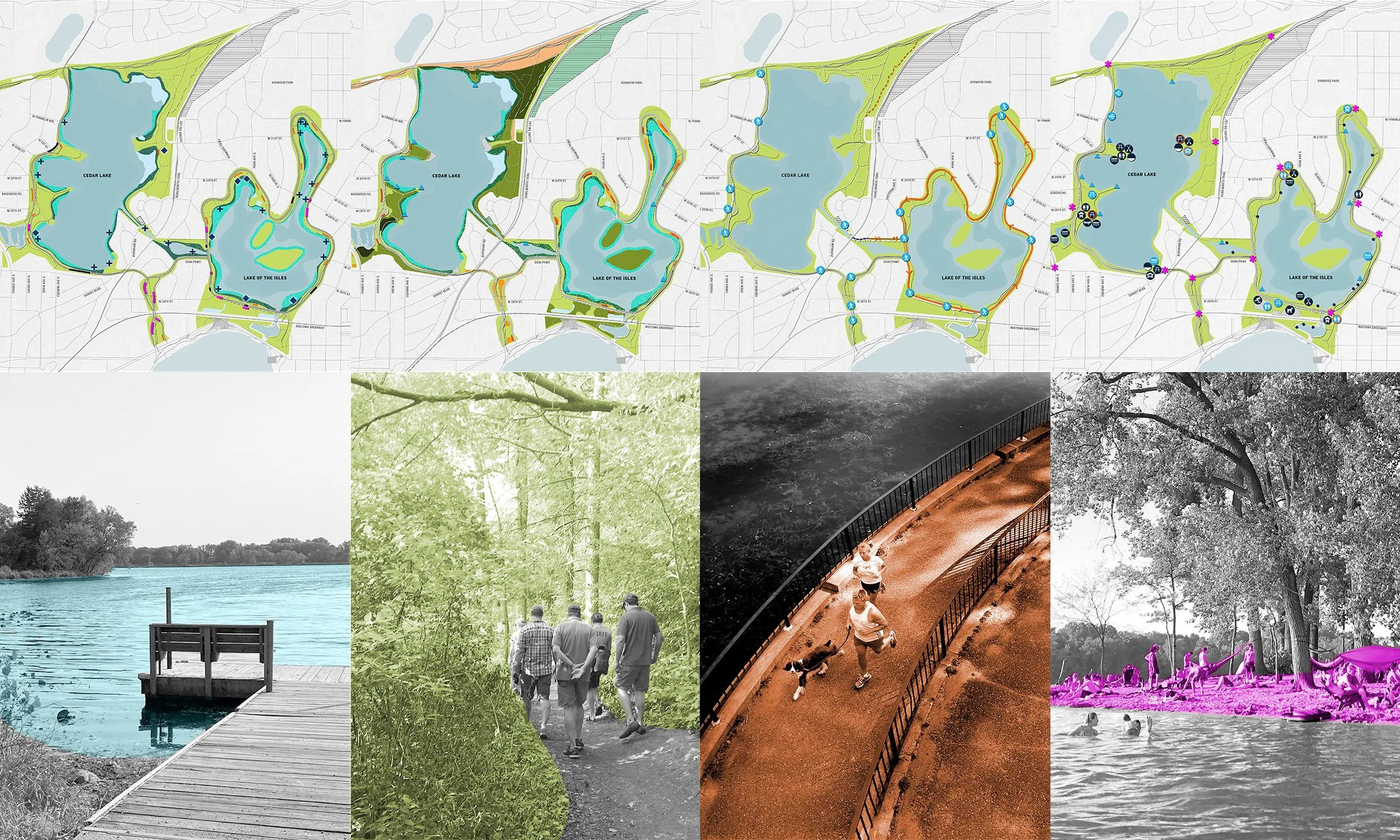
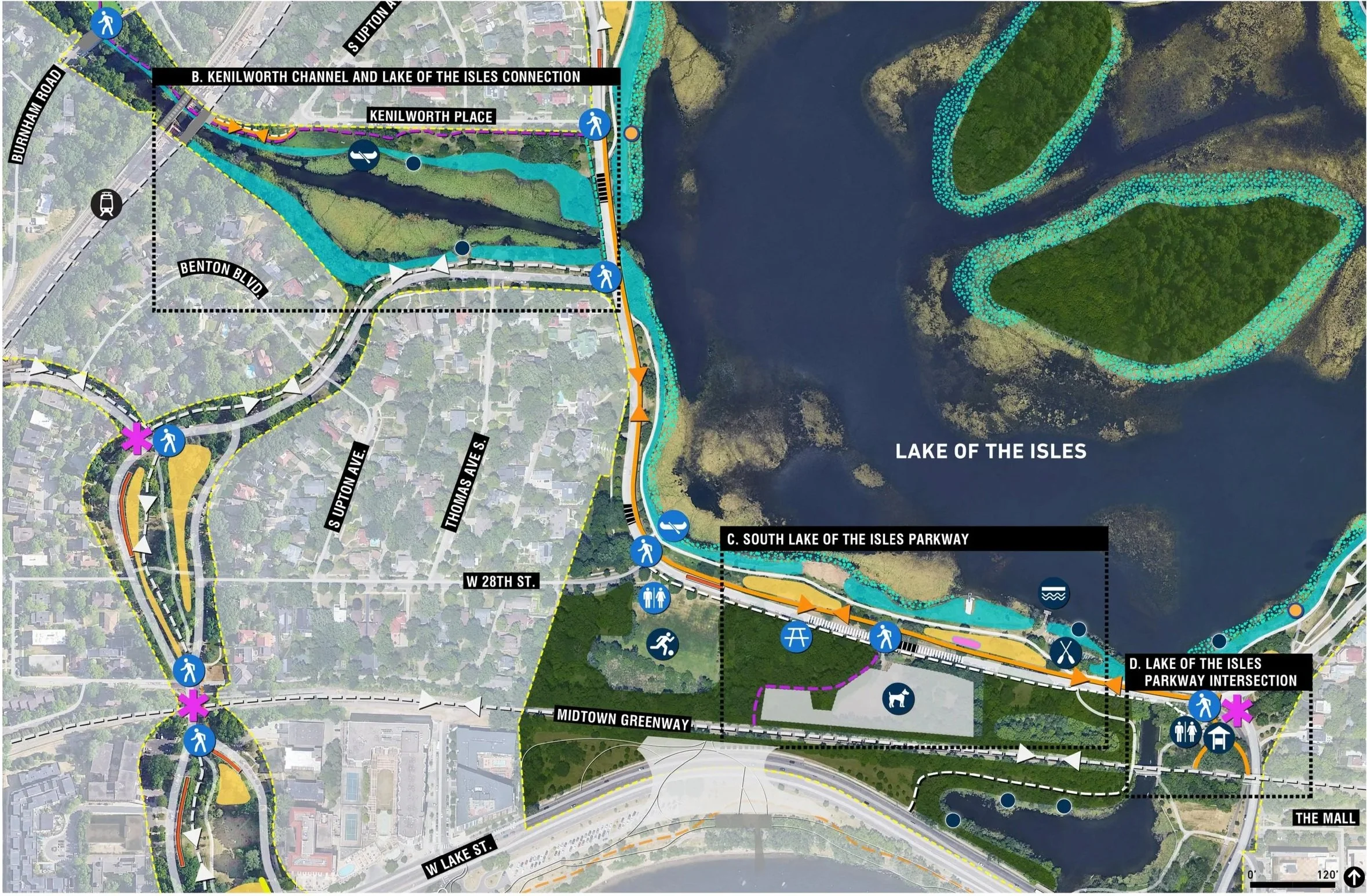
In partnership with the Minneapolis Park and Recreation Board (MPRB), TEN x TEN led a multidisciplinary team through a three-year planning effort to develop the Cedar-Isles Plan—a long-range framework for the stewardship and enhancement of Cedar Lake, Lake of the Isles, Dean Parkway, the Kenilworth Channel, and portions of the Cedar Lake Regional Trail. As part of the Chain of Lakes Regional Park, these beloved landscapes form a vital urban natural ecosystem that protects, connects, and sustains people, wildlife, and natural resources. The plan balances ecological restoration, historic preservation, recreation, multimodal circulation, and the diverse needs of park users to create a more resilient, accessible, and enduring park system.
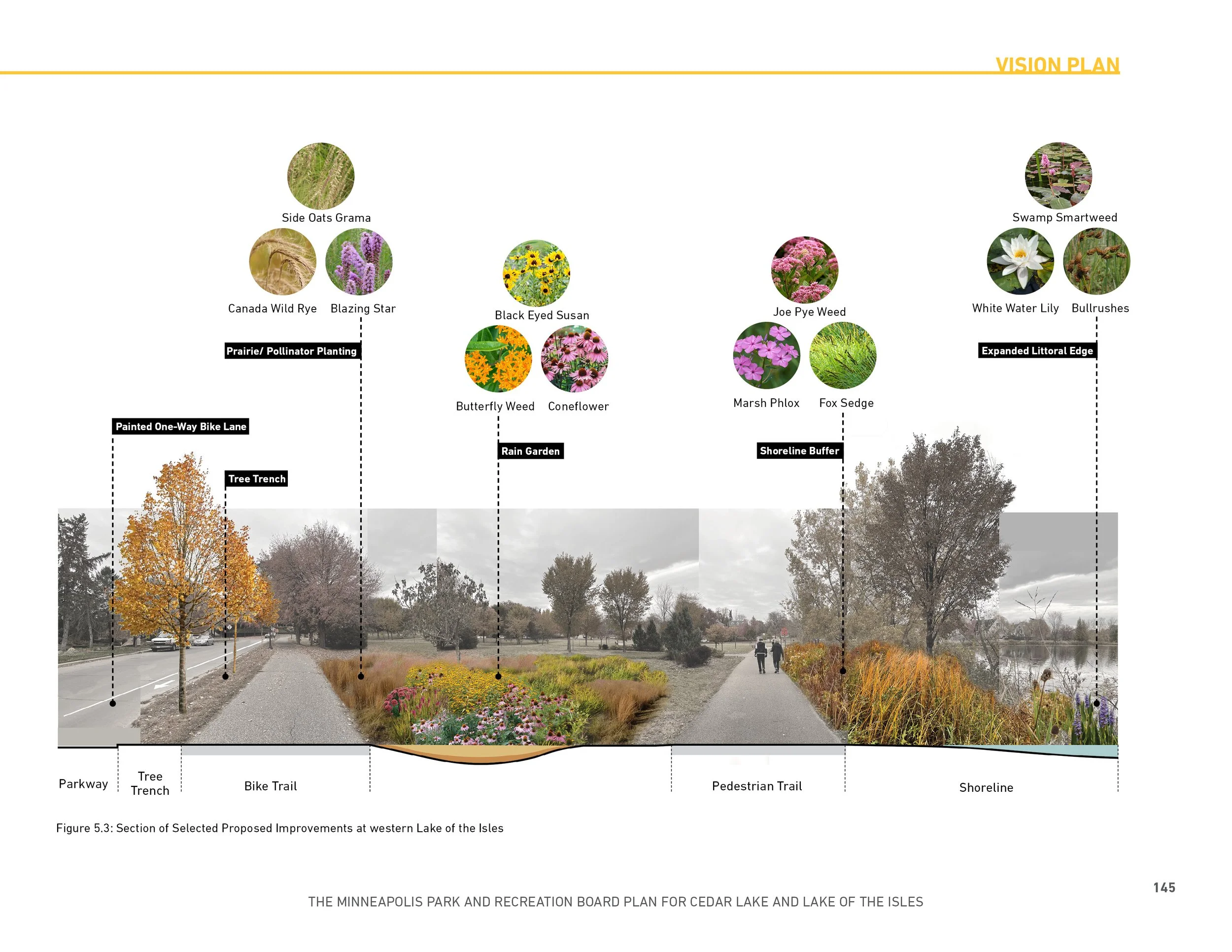
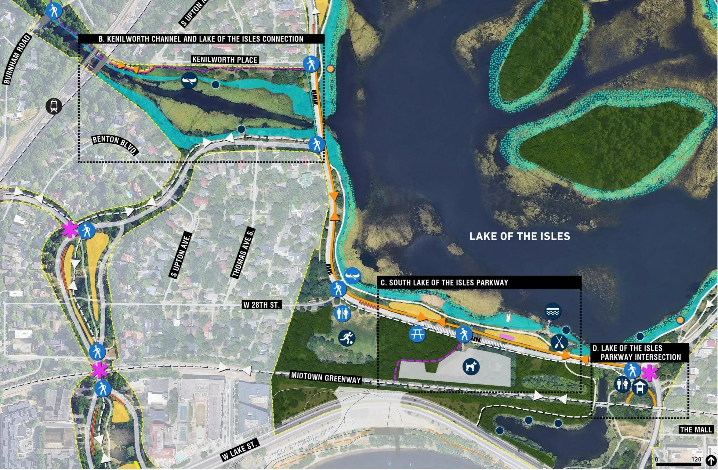
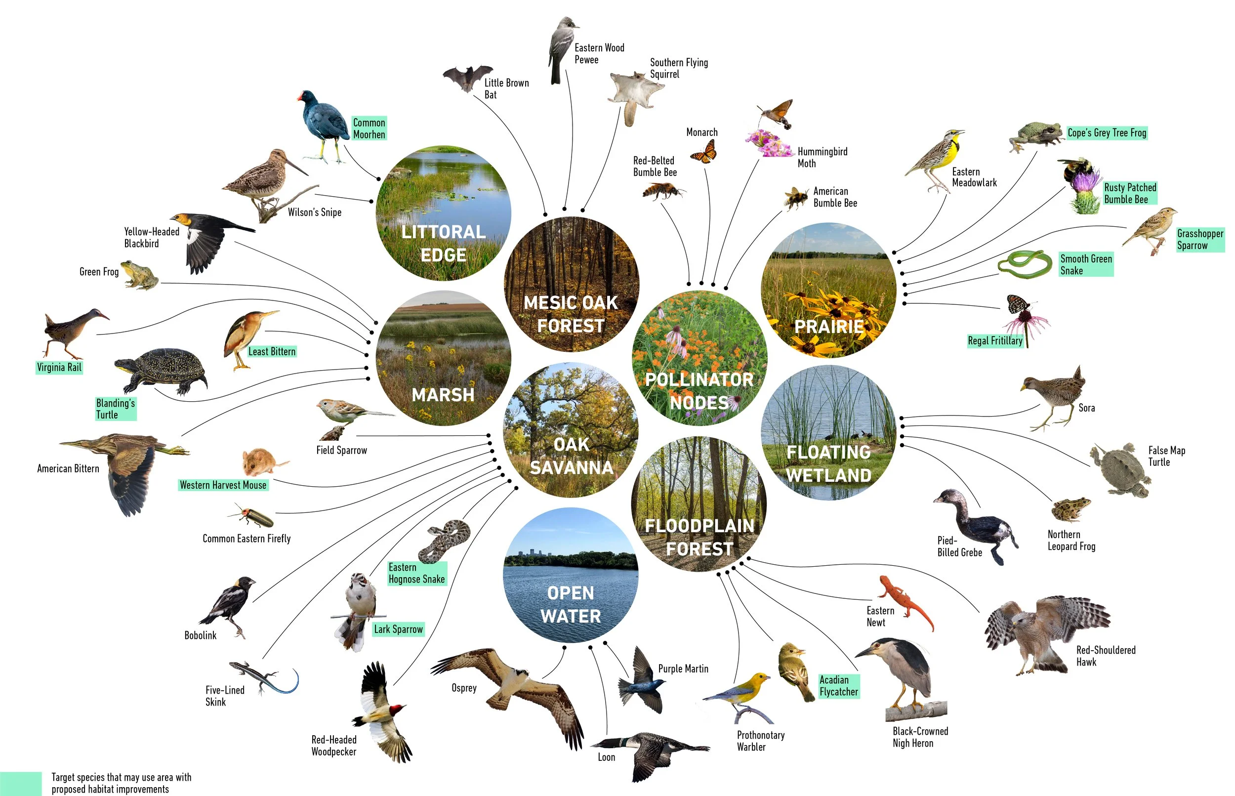
Key initiatives include improving water quality, restoring native landscapes, enhancing trail and pedestrian connections, refining amenities and wayfinding, and strengthening public access while respecting the area's historic and cultural significance. Developed through an extensive community engagement process spanning more than three years, the plan provides designers with a comprehensive vision that prioritizes environmental performance, user experience, and context-sensitive design as future capital improvements are planned and implemented. Proposed improvements address water quality by treating stormwater runoff, minimizing impermeable surfaces, and stabilizing shorelines with native vegetation, while simultaneously expanding habitat opportunities, restoring land and water-based ecological communities, and enhancing nature-based recreation.
-
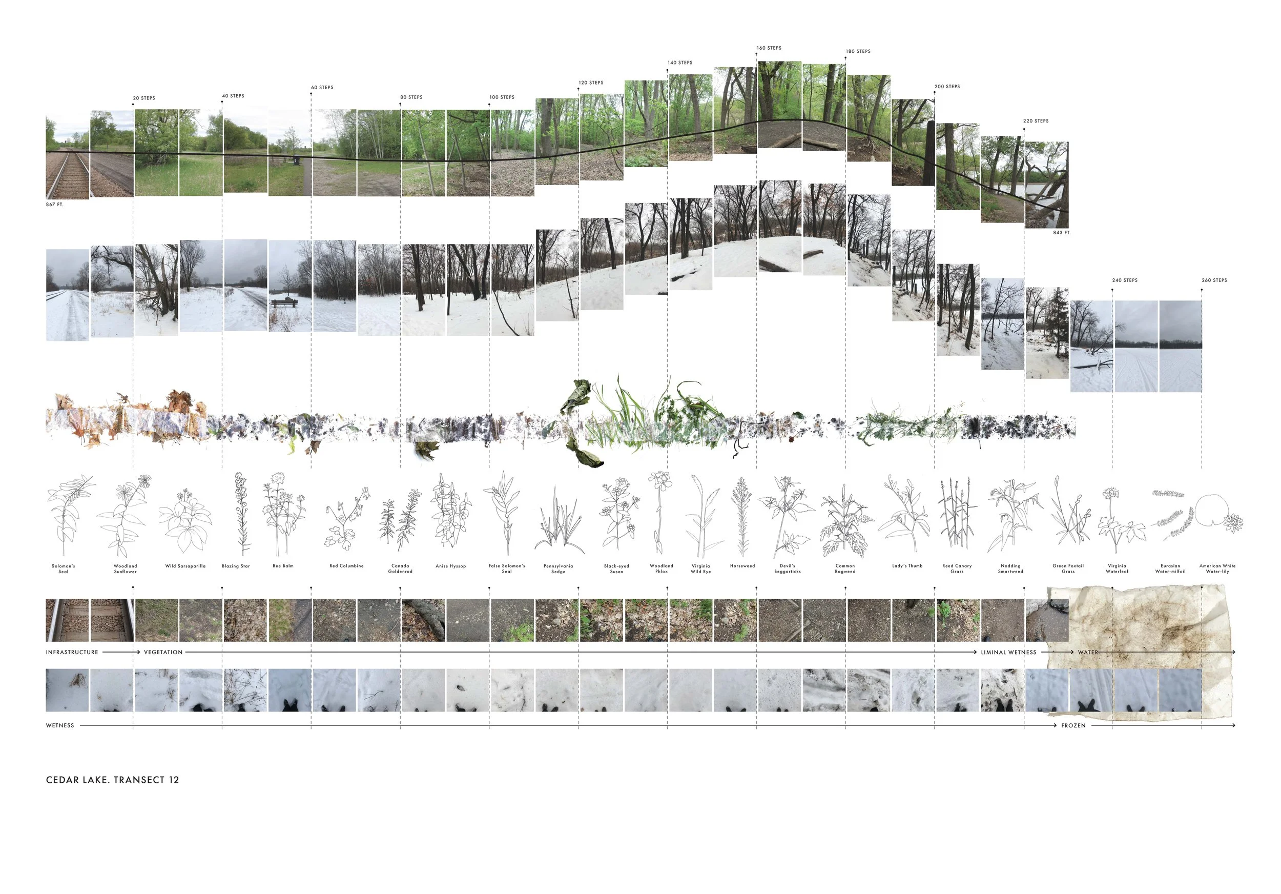
The parkland surrounding the lakes is relatively narrow, ranging from 25 to 500 feet wide, with 60 feet being the most common width. Because of this, the lake edges are a defining feature.
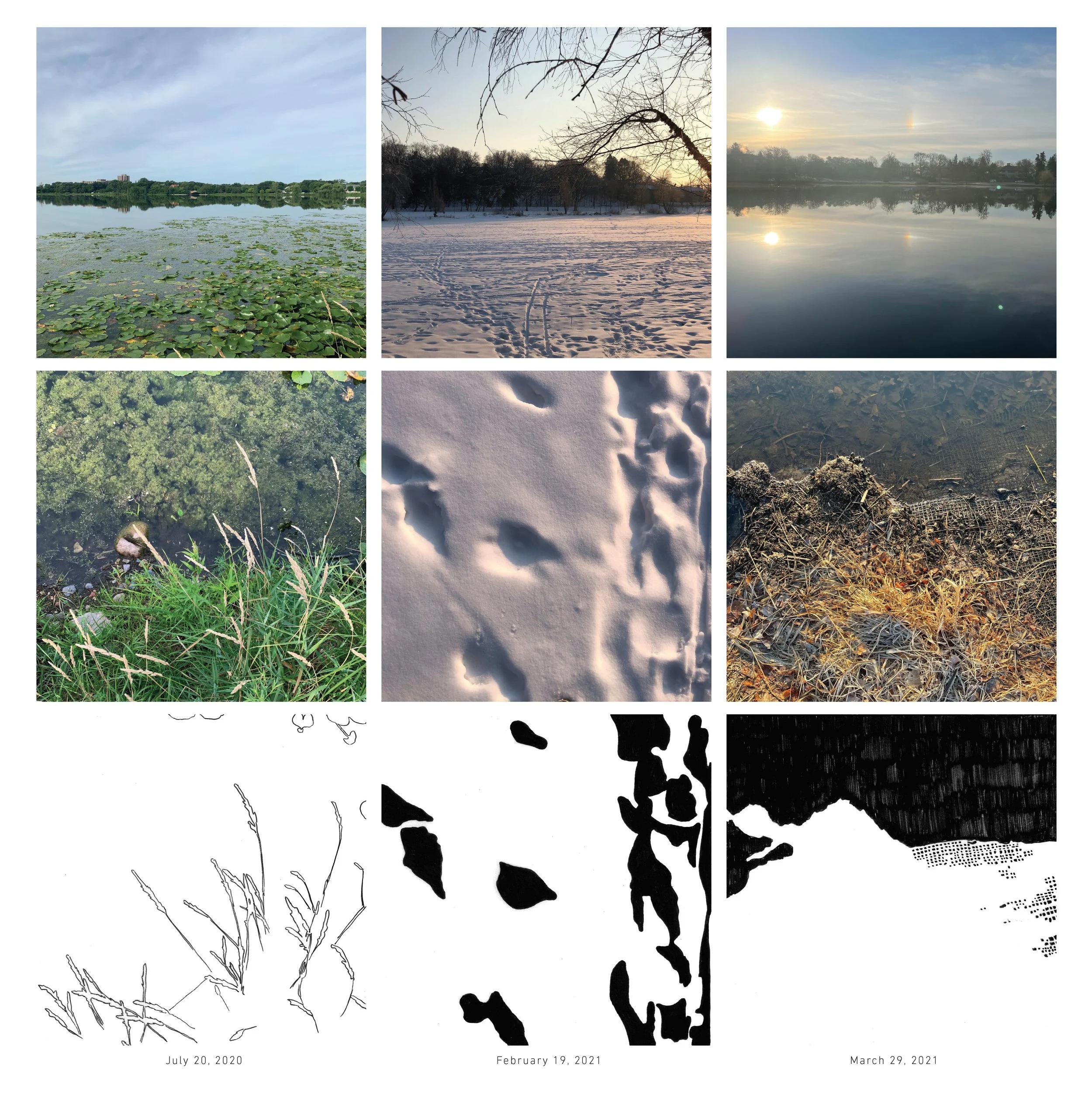
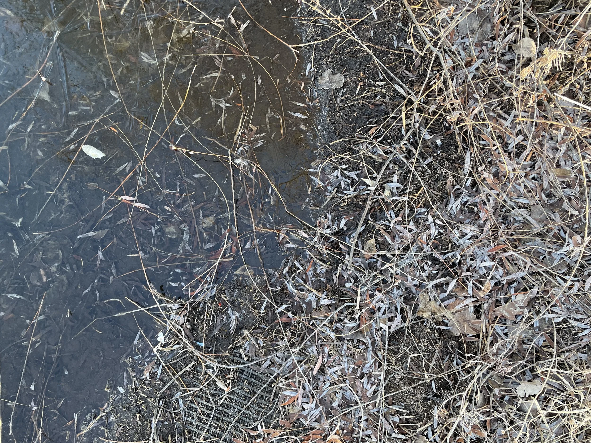
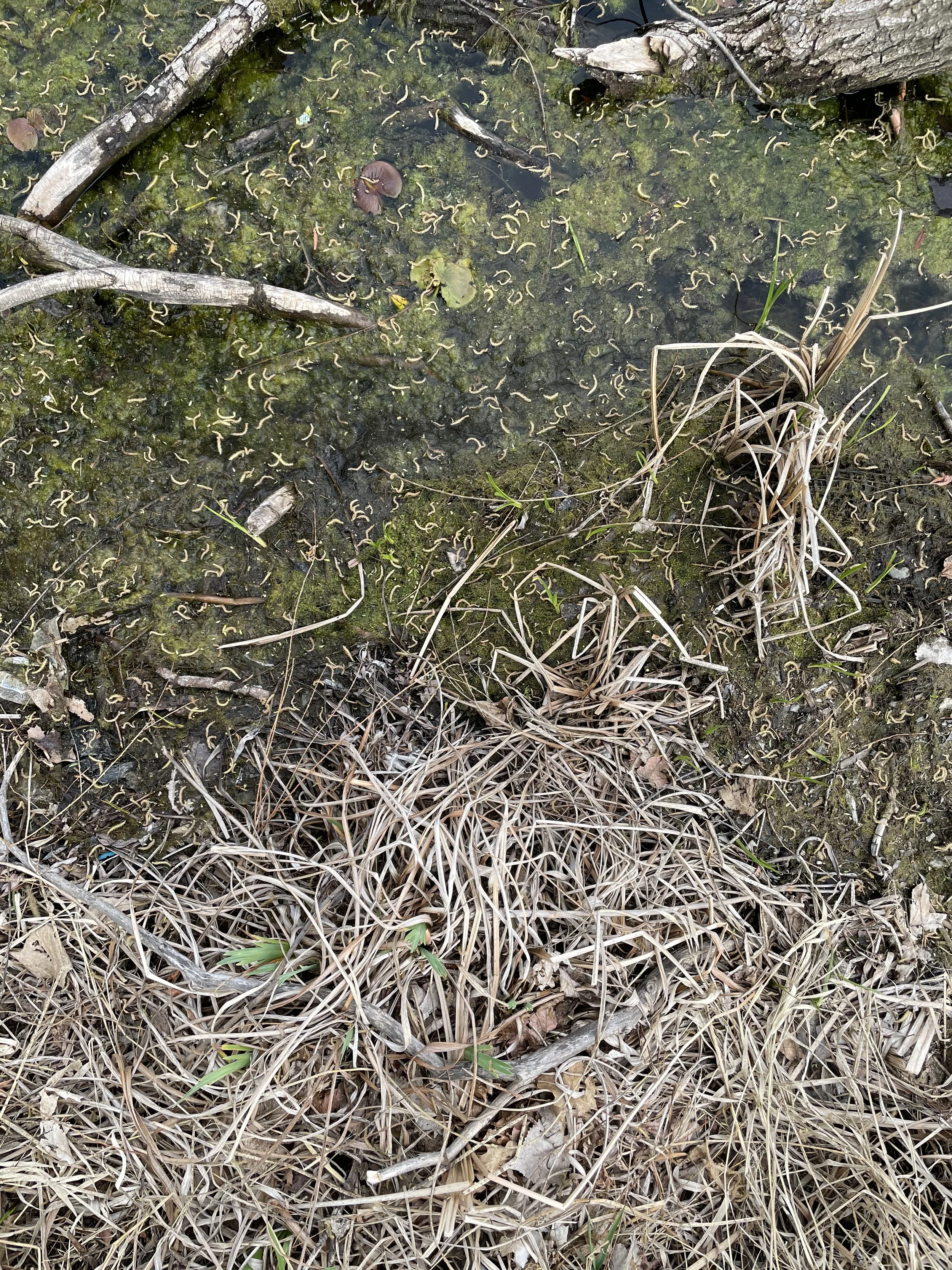
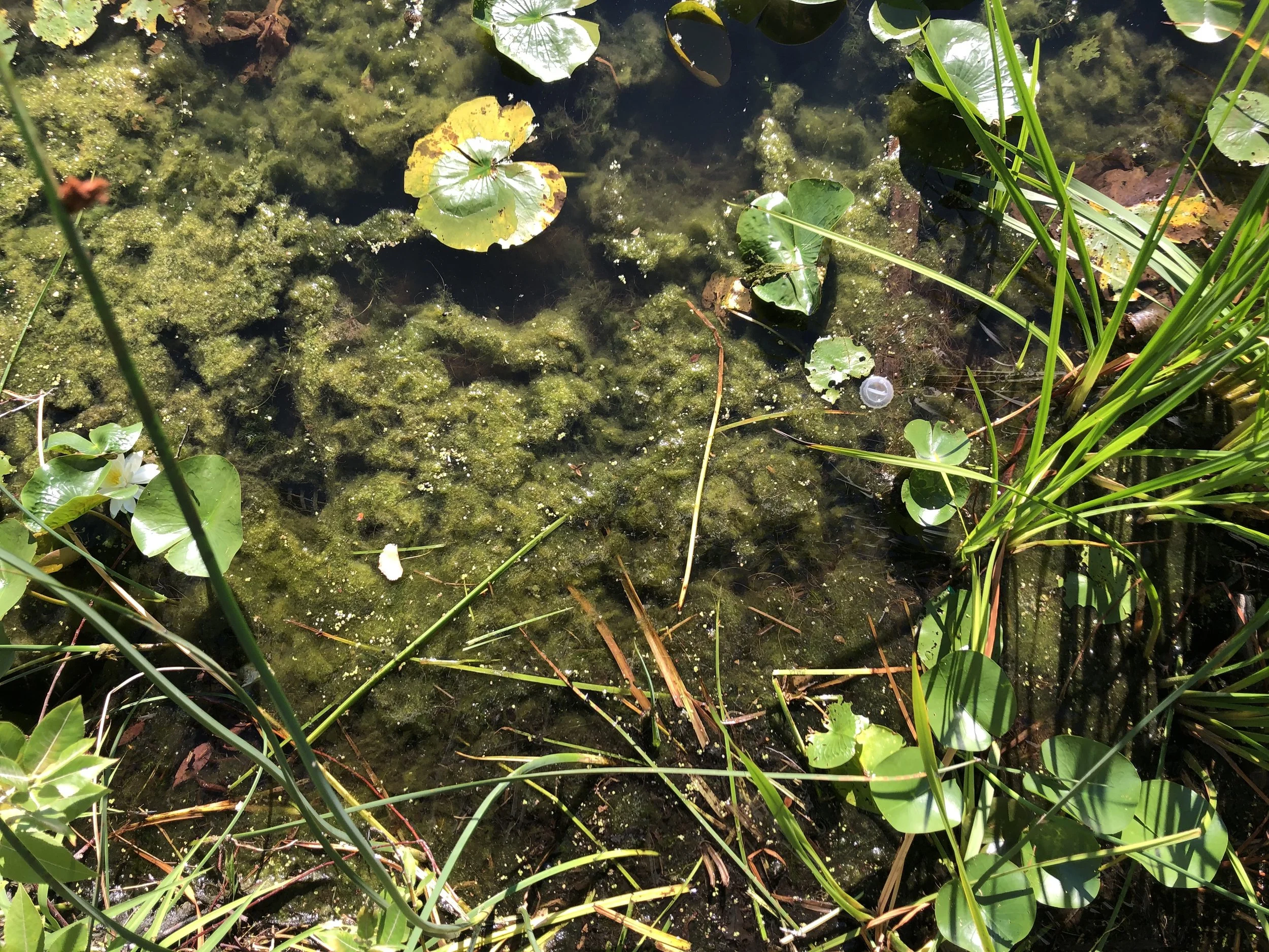
The team examined edges through several methods: plant inventories, serial photography, material exploration, and large format drawings and sections. Material explorations aimed to collect and witness the medium of the site itself (the mud, water, and plants) as it exists across all four seasons. The public was also engaged in community mapping activities during peak recreation times aimed at documenting collective rituals of use, memory, and connection.
The deep study of this territory revealed that lake edges are dynamic and that the monolithic, rigid, and hardened edges around Lake of the Isles and parts of Cedar Lake no longer serve the various needs of park users. As a result, the final plan centered on the lake's edges and narrow thresholds of parkland as a pivotal opportunity for wildlife habitat, biodiversity, and ecological resilience through flood control and various water quality improvement strategies.
-
Through thoughtful facilitation, the planning team brought together a diverse range of voices—including city leaders, wildlife advocates, neighbors, historians, regional park users, and many other participants. The final plan was organized around seven key topics: Water Quality, Natural Resources, Access and Circulation, Accessibility, Safety, Historic and Cultural Resources, and Program and Amenities. To guide the design process, the team developed a set of guiding principles that reflected core values, especially water quality improvement and natural resources stewardship, that emerged throughout the engagement efforts.
The collective vision for the project was to shape a unified and balanced plan—one that thoughtfully integrates environmental restoration with accessibility and community benefit.
PROJECT DETAILS
Location Minneapolis, Minnesota
Client City of Minneapolis
Team TEN x TEN, EOR, Quinn Evans, Hesse Roise, MSR Design, Mend Collaborative
Area 250 Acres
Status Complete
AWARDS